Major River Systems of India and Their Tributaries
Are you ready for UPSC Exam? Check your preparation with Free UPSC Mock Test
Rivers in India owe a divine status in Indian history. Each stream has something special attached to its geographical location, ancient mythology, and physical demography.
As a result, their auspicious presence engenders the construction of a united and integral nation, rich in both culture and heritage. Thus, here is a detailed description of the major river systems of India.
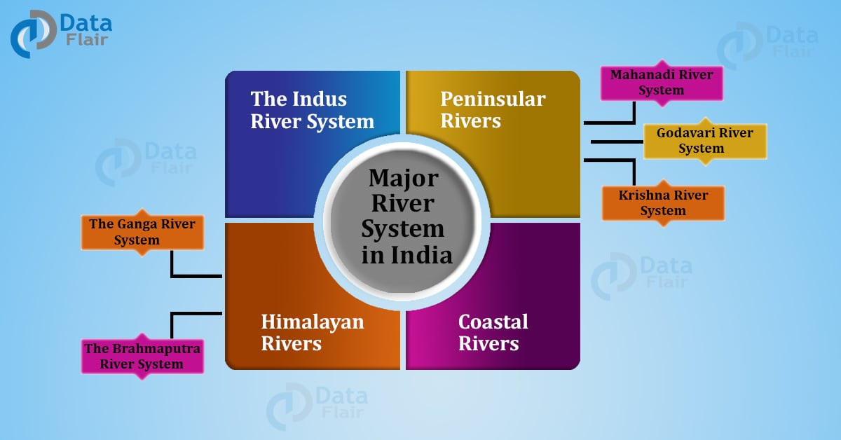
The rivers of India undergo a primary classification premised on their geographical initiation. In this sense, there exist three significant categorizations of the rivers:
- Himalayan Rivers
- Peninsular Rivers
- Coastal Rivers
Each of the categories, as mentioned above, is branched into various river systems of India flowing through the Indian terrain. The article elucidates these Indian river systems and provides information about the various rivers flowing over the Indian terrain.
Himalayan Rivers of India
As the name indicates, the Himalayan river system constitutes the rivers which directly touch the Himalayan mountains during their course of flow. This includes the Indus, Ganga and the Brahmaputra as rivers forming in and through the Himalayan region.
These three rivers form a large basin while the surrounding precipitous rocks cover these deep river valleys. According to geographical historians, these valleys were a result of drastic Himalayan uplifting.
As per later reports, the down-cutting of these three rivers flowing through the Himalayan belt led to this uplifting in the mountainous region.
Next, the Himalayan rivers are perennial. This is because their freshwater comprises both from the melting of the ice caps and that of the rainfall.
The nearby areas around these rivers are mostly plain, which are easy to navigate, in and around. Besides, the water of this river system also generates hydroelectricity in these plain regions.
1. The Indus River System of India
The Indus river originates from the Kailash hills in Tibet, near the Mansarovar region. It enters India from the states of Jammu and Kashmir. This lever has a total length of 2897 km and finally terminates at the Arabian Sea.
The Indus river has numerous tributaries. Some of its main tributaries are, the Zaskar, the Nubra, the Shyok, and the Hunza. These tributaries blend together in Kashmir, the entry point of the Indus river in the Indian territory.
Moreover, the river transcends the Himalayas by forming deep gorges near Attock. The gorge size at this place accounts for around 5181 m. In fact, the river flows through three Asian countries namely China, India, and Pakistan before its final wedlock with the Arabian Sea in the west.
The main tributaries of the Indus river system are as follows:
a. Chenab
A blend of two small rivers, Chandra and Bhanga, Chenab runs parallel to Pir Bhangar mountains. Also referred to as Chandrabhaga in Himachal Pradesh, the river flows through Punjab and further conjugates with Jhelum.
b. Jhelum
This tributary of Indus originates in Southern Kashmir. From there, it flows into the Wular lake and later cuts through the Pir Banjar ranges. Its course of flow is mainly the Indo-Pak border before joining with Chenab.
c. Satluj
Originating in the Rakka lake, the river flows from Tibet and subsequently flows north-west. It enters Himachal Pradesh at the Shipki pass.
Having a total length of 1500 km, it cuts a deep gorge in Naina Devi Dhar, located in Punjab. This is the point of Bhakra Nangal Dam, one of the largest hydropower dams in India.
d. Ravi
Originating in the Rohtang pass in the Kangra valley, the river flows along the Indo-Pak border. With a total length of 720 km, it joins with Chenab before entering into Pakistan.
Following a north-west course of flow, the river passes through Dalhousie in Himachal Pradesh. Subsequently, it cuts deep gorges at Dhauladhar hills before entering into Pakistan.
e. Beas
It originates in Beas Kunj and runs across two Himachal districts, Kullu and Manali. The river enters the Punjab plain near the Mirthal region. It covers a total distance of 615 km while flowing.
2. The Ganga River System of India
Hailed as the mother of all rivers in India, the river Ganga records a holy presence since the ancient civilizations. And even today, thousands of worshippers from far-off nations come to taste its divinity and bathe in its sacred waters.
Like a river of the Himalayan belt, Ganga shares its geographical boundaries with ten different states. One of the largest river systems of India, it covers around 26.3% area of the country.
Originating in the Gangotri glacier, it is also known as Bhagirathi in Uttarakhand. The river meets the Yamuna at a place called Sangam, located in Allahabad (now known as Prayagraj). Finally, it terminates at the Bay of Bengal near Sagar Island.
Ramganga, Gharghar, Gomti, Som, Yamuna, Kosi, Gandhak and Mahananda are some of the tributaries of Ganga river system.
3. The Brahmaputra River System of India
Unlike other river systems of India, which possess a motherly status in Indian myths, Brahmaputra is the only son, the “Putra” of the mighty Brahma.
Originating in the Mansarovar lake, Tibet, the river flows in the eastward direction and finally terminates in The Bay of Bengal. In fact, it is known by different names in different regions through which it passes. For instance, it is referred to as Dihang in Arunachal Pradesh, and Tsangpo in Tibet.
Further to this, the river carries massive silt deposits while flowing on the Indian terrain. Like a river, it has a history of causing floods in monsoon seasons. For example, the river went furious and deteriorated the lands of Assam and Bangladesh due to massive rainfall.
Peninsular Rivers of India
Peninsular river system comprises six major south-flowing rivers of India, namely, Mahanadi, Godavari, Krishna, Kaveri, Narmada, and Tapi.
Most of these peninsular rivers are seasonal as their flow is highly dependent upon rainfall. In fact, unlike the Himalayan rivers, the peninsular rivers through shallow valleys. More to this, their erosional capacity is also low as compared to the rivers flowing in the Himalayan belt.
Therefore, down-flowing rivers with a lesser amount of sand and silt deposits, these rivers have an exceptional utility value in terms of generating hydropower for nearby states.
1. Mahanadi River System of India
Originating from Satpura ranges in Madhya Pradesh, it flows eastwards into The Bay of Bengal. The river crosses the states of Orissa, Jharkhand and Chattisgarh and Maharashtra while flowing.
About 860 km in length, the river houses the famous Hirakud dam on its banks.
2. Godavari River System of India
Also known as Vriddh Ganga or South Ganga, Godavari river system is the second largest river system in India. Similar to Ganga, people from different parts of the country worship at the banks of this river.
Having a total length of 1,450 km, the river begins from Nashik city of Mumbai (around 340 km distance from the Arabian sea). It covers a major portion of central India during its flow.
Besides, it is a seasonal river system that swells up in Monsoon and runs dry during Summers. In fact, it installs the largest bridge or engineering feat, linking Kovvur and Rajahmundry, of Asia.
Similar to Ganga, the banks of Godavari are occupied by people who believe in the divine powers of the river. Nasik, Bhadrachalam, and Triyambak are a few of the pilgrimage spots near the river.
Besides the above, the water of Godavari is brown in color. Some tributaries such as Indravati, Bindusara, and Sabri also branch out of the river.
3. Krishna River System of India
Originating from Mahabaleshwar in Maharashtra, the Krishna river system terminates in the Bay of Bengal. In between, it passes through the states of s Karnataka and Andra Pradesh before flowing eastwards.
Around 1300 km in length, this river system carries a mytho-historical significance. According to the Puranas, the river sprouted from the mouth of a cow, and Mahabaleshwar temple installs a statue of the same sprouting.
4. Kaveri River System of India
The river originates from Talkadevi in the Western Ghats and empties into the Bay of Bengal after running through the states of Karnataka and Tamil Nadu.
The basin of the Kaveri river is around the length of 71,700 km square. It has tributaries such as Honnuhole, Kabini, Amaravati, Shimsha, Hemavati, etc.
Also known as Cauvery or Kavery, it has massively contributed to the ancient kingdoms of South India. The total length of this mighty river is around 768 km. Today, multiple tourist hotspots appear to have developed in and around its source of origination.
Therefore, people in huge numbers visit the Kaveri banks in the tourist season mostly around the areas of Brahmagiri hills near Madikeri.
5. Narmada River System of India
A river of central India, the Narmada river system acts as a threshold of bifurcation between the northern and the southern regions of the country. Around 1289 km in length, it flows from east to west direction and terminates in the Arabian sea.
Rising in the Amarkantak hills, the river flows across Madhya Pradesh, Maharashtra, and Gujarat before its final downflow.
6. Tapi River System of India
Possessing a length of 724 km, the Tapi river systems of India (similar to the Narmada) travels eastwards to westwards. Moreover, Crossing Madhya Pradesh, Maharashtra, and Gujarat, the river touches the different cities and districts of the nearby regions.
The river crosses major areas such as Khandesh and east Vidarbha regions in Maharashtra, the edges of the Deccan Plateau before entering Gujarat.
Mostly, its basin lies in the northern and eastern districts of Maharashtra such as Amaravati, Dhule, Betul, Malegaon, Burhanpur, etc.
Besides the above, Wagur, Panzara, Pura, and Girna are some of the key tributaries of Tapi river.
It finally empties in the Arabian sea around the Gulf of Cambay.
Coastal Rivers of India
Most of the coastal rivers are comparatively small as opposed to those in the Himalayan and the Peninsular belts. These rivers surface around the eastern and western coasts of India.
In fact, there are around 600 or more small rivers and streams in the western coastal plain. These rivers do not carry heavy silt or sand sedimentations. Moreover, their flow never takes them eligible to terminate into the main sea.
Some of the coastal rivers either drain into salt lakes or vanish in the deserts during their flow.
Luni, Machu, Rupen, Banas, Saraswati, and Ghagar are few of the coastal flowing rivers. Each of these rivers is unable to make a successful outlet to the territorial seas.
Conclusion
This was all about the major river systems of India. Overall, rivers are an essential source of water and electricity to us. Therefore, we must respect their sanctity and keep them clean.
To follow the above sincerely, we must support the government in their major river cleaning plans. The Ganga Action Plan of 1986 was one such initiative. Moreover, factories and manufacturers must adhere to legal policies and guidelines and prevent the contamination of nearby rivers.
Also, the rivers in which houses the major dams should follow the special instructions from their local authorities. Therefore, each and every individual should take the initiative to protect and preserve this ancient heritage.
In a nutshell, the conservation of rivers and the maintenance of their hygiene and sanitation is our premier responsibility. And we must fulfill it with all our dedication and sincerity.
Your opinion matters
Please write your valuable feedback about DataFlair on Google